Honeymoon Valley Landcare Charitable Trust
We began in 2014 and our Charitable Trust was registered in 2015. Our project has gradually expanded and we concentrate on action on the ground.
We started on the upper catchments of Honeymoon Valley, including Honeymoon Valley West. The headwaters border Maungataniwha Forest which is part of Northland Conservation Park, administered by Department of Conservation. This stretches around over half our project boundary and we do a pest control contract in this buffer area.
Our Honeymoon Valley Landcare project is one of the sub-catchments of the Doubtless Bay/Tokerau water catchment of 55,000+ hectares. The rivers of Honeymoon Valley, Peria and Oruru flow out to the sea at Taipa estuary.
We network with the adjoining areas of the wider Peria community out to Doubtless Bay as we are all connected in the same bioregion and water catchment, from the maunga / mountains to the moana/ sea.
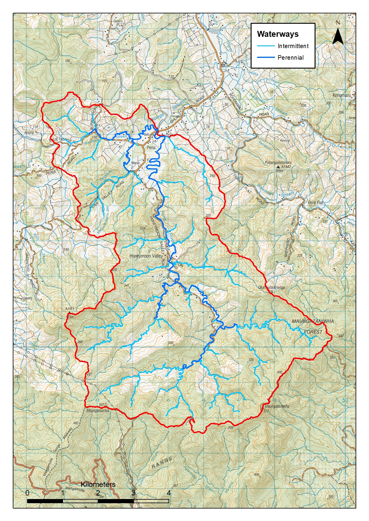
Honeymoon Valley Catchment Map
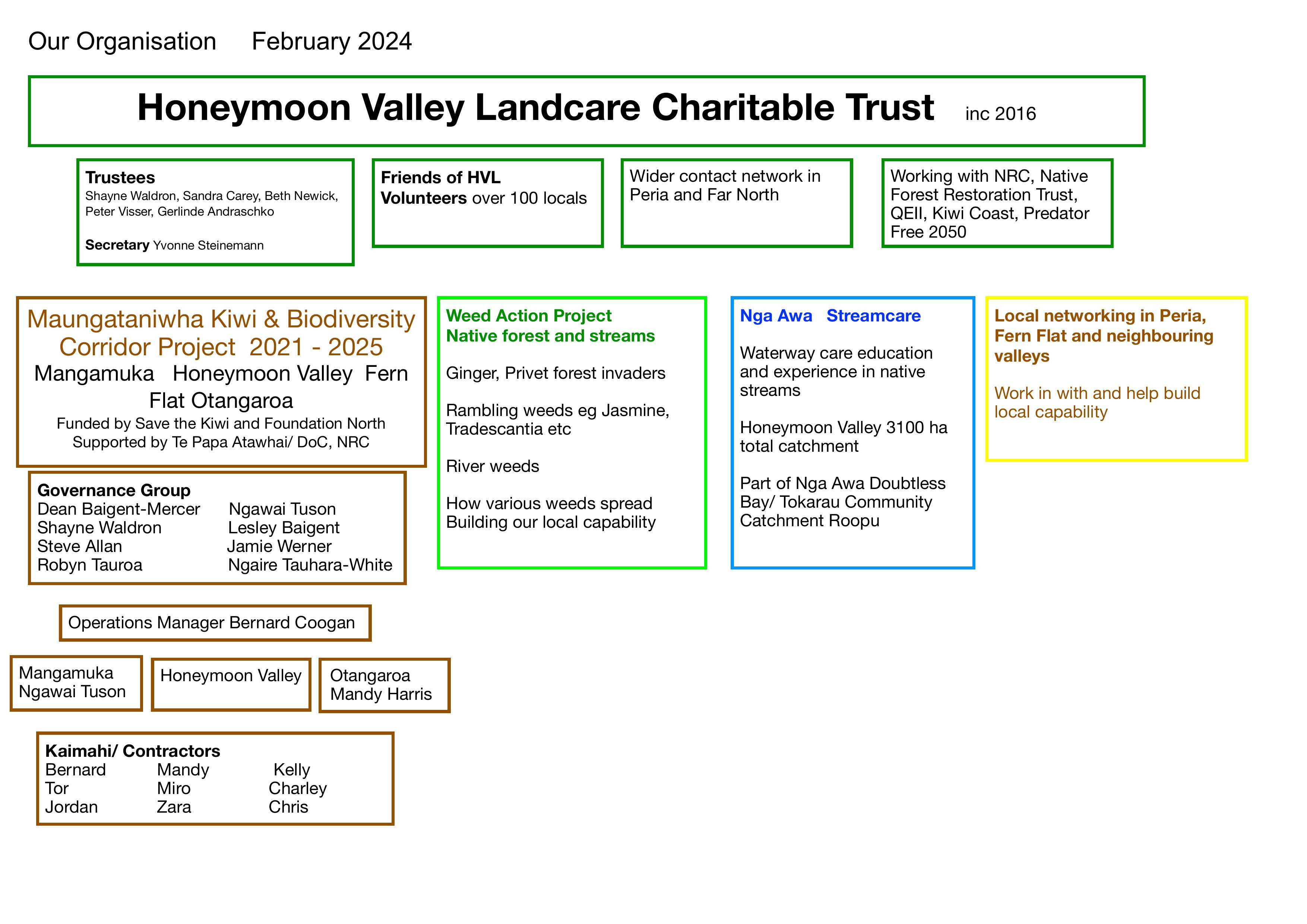
Honeymoon Valley Landcare Charitable Trust Organisational Chart - 2024
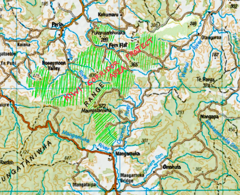
Otangaroa - Maungataniwha - Mangamuka Kiwi Corridor and Biodiversity Project
- In 2020 our Trust expanded to facilitate the Otangaroa - Maungataniwha - Mangamuka Kiwi Corridor and Biodiversity Project which has now grown to 7000 hectares, funded by Save The Kiwi, Jobs for Nature and Foundation North. This Corridor encompasses some of Northland’s most ecologically diverse forest east to west on the Maungataniwha Range on Te Papa Atawhai/Department of Conservation Land together with more than 25 neighbouring private landowners.
- We network with neighbouring groups in all directions towards this shared nature corridor project. Maungataniwha Forest connects us all.
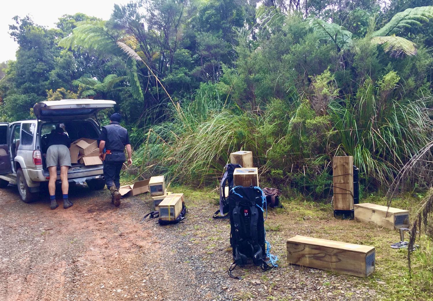
- We have over 164km of trap lines with over 1800 traps with catch efficiency continually improved
- Funding is secured until June 2025 for our 8 part-time professional hunters to regularly service all of our trap network based on best practice
- Pest control tracks are regularly upgraded and maintained for better quad bike and walking access
- Trap lines are mapped and catch results are reported on trap.nz as shown on the map below
Otangaroa Maungataniwha Mangamuka Kiwi Corridor Project
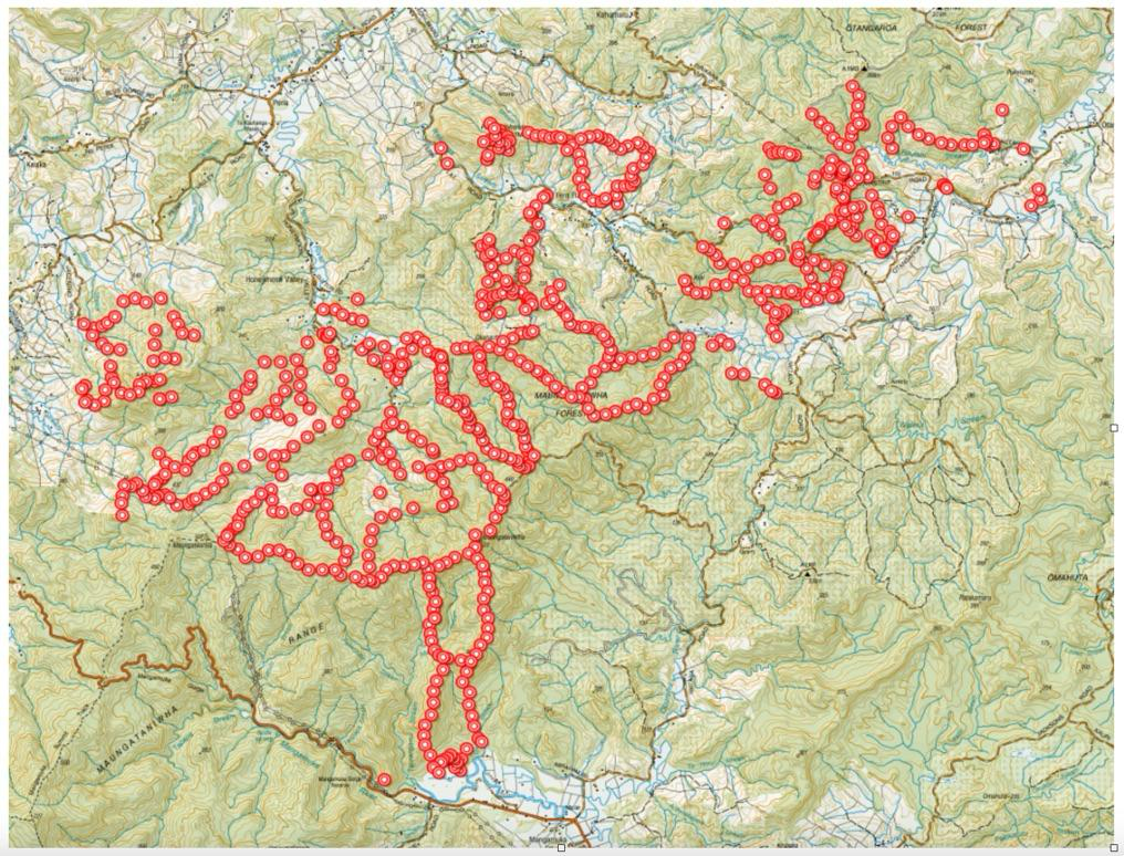
Trap locations in 7000 ha Kiwi Corridor Project
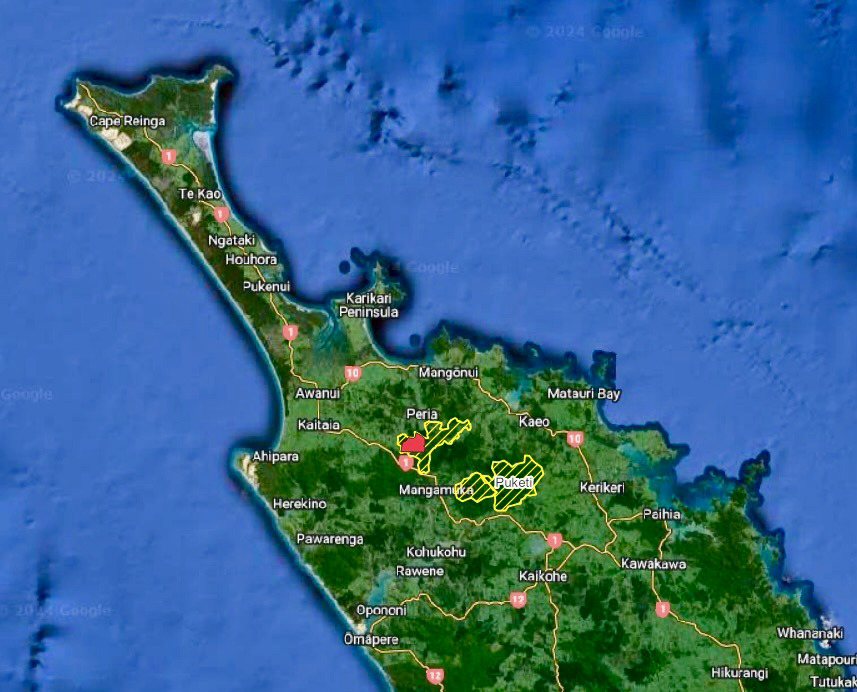
Honeymoon Valley Landcare Trust area in red within the larger Kiwi Corridor Project area, showing nearby Puketi and Omahuta Forests
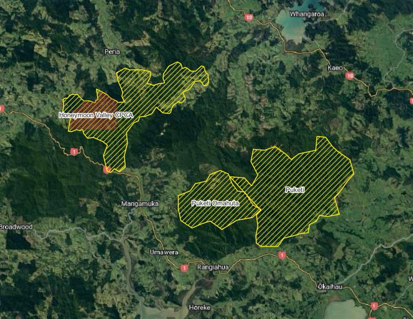
Community Pest Control Area (CPCA) shown in context with Maungataniwha Forest Corridor Project and Puketi and Omahuta Forests
History
Maungataniwha has been a taonga for many generations. Hapu from north, south, east and west whakapapa to this maunga.
Many people have lived in the Peria and Oruru valleys for centuries, with a rich Maori history.
Farming started in Honeymoon Valley over 100 years ago, and loggers harvested many mature native trees up until the 1970’s. Lifestylers then increased in numbers, and much of the steep hill country regenerated.
Exotic forestry plantations took a hold in parts of the valley farmland in the early 1990’s and much of this is starting to be logged now. Larger private areas of land at the headwaters of the valley are in rapid regeneration to native bush and some titles are now legally protected for conservation in perpetuity.
Topography and vegetation
Honeymoon Valley is nestled into the northern side of the Maungataniwha Range, in Peria, in the Far North of New Zealand.
Maungataniwha Forest and areas nearby are listed as outstanding landscapes under the Far North District Council plan. The land here is a mixture of relatively steep country draining into numerous streams, with some wetlands, and rolling to slightly flat areas that were farmed in the past.
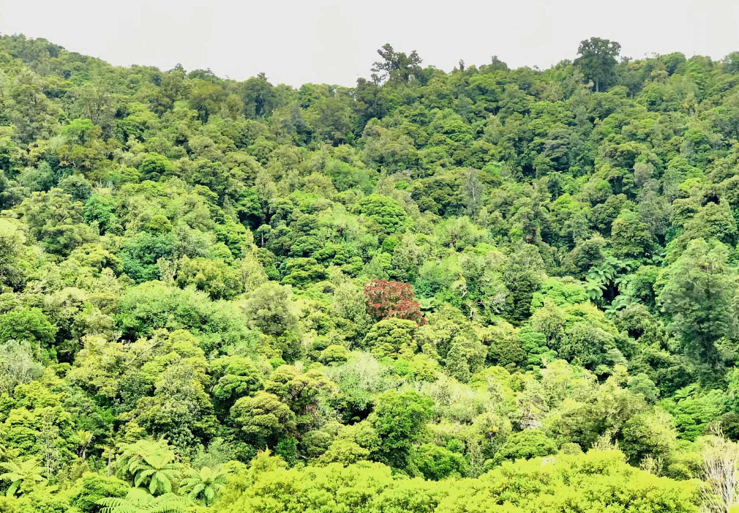
Natural gems in the landcare area include healthy rocky bottomed streams, waterfall pools, numerous outstanding Puriri, Taraire and Northern Rata, with some ancient Kahikatea and mature Kauri.
The land here is unusual as northern slopes were the most easily cleared and burnt in the pioneering period, and relatively few areas remain with good vegetation cover outside Maungataniwha Forest Park presently managed by Department of Conservation. Northern slopes offer high regenerative growth rates.
Our Charitable Trust
We focus on action on the ground. We offer tax deductible donations towards our project.
We have two meetings per year – autumn and spring. We have a bank account and submit annual reports to the Charities Commission.
Group Members & Roles
Trustees
- Chairperson - Shayne Waldron
- Treasurer - Shayne Waldron
- Gerlinde Andraschko
- Sandra Carey
- Beth Newick
- Peter Visser
Governance Group
Overviewing and providing strategic direction to the Otangaroa - Maungataniwha - Mangamuka Kiwi Corridor and Biodiversity Project
- Shayne Waldron (Honeymoon Valley Landcare Charitable Trust chairperson)
- Ngawai Tuson (Te Rotoawanui O Mangamuka Ahu Whenua Biodiversity and Conservation Project)
- Dean Baigent-Mercer (Otangaroa Landcare)
- Lesley Baigent (Kiwi Coast)
- Steve Allan (Predator control and monitoring)
- Kylie McDowell (Kaitiaki hapouri whanui | Community Ranger - Department of Conservation, Kaitaia)
- Robyn Tauroa (Otangaroa Marae)
- Ngaire Tauhara-White (Te Paatu ki Kauhanga Trust Board) with support from Tina Latimer, Secretary
Maungataniwha Kiwi Corridor Project
- Project Manager - Bernard Coogan
- 8 part-time Pest Control Contractors
- Secretary - Yvonne Steinemann
Friends of Honeymoon Valley Landcare
- over 150 supporters
Funding for our projects have been received from
- Save The Kiwi
- Ngā Kairauhī Papa/QEII Nature Reserves Trust (Stephenson Fund)
- Foundation North
- Predator Free 2050
- Northland Regional Council BioFund
- Volunteer fundraising
- Donations by private individuals
Partners we work with
-
Native Forest Restoration Trust – Puhoi/Mangakawakawa Reserve – neighbouring pest control
-
Summit Logging – neighbouring pest control
-
Te Papa Atawhai/Department of Conservation Kaitaia – neighbouring pest control
-
QEII National Trust covenanted properties